RowsleyStantonMoorAlportMiddletonEltonBirchoverDarleyRowsley
7th November 2008
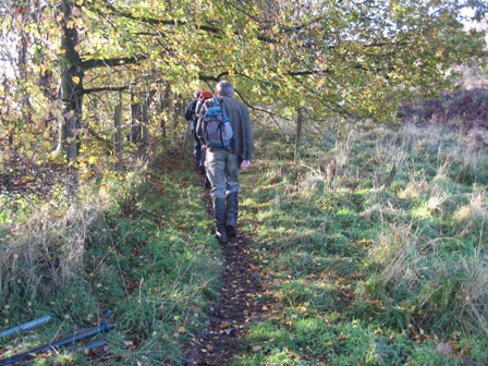
Who Went: PNO, PH, JK
Weather: It rained the entire journey to Rowsley but as we stopped the rain stopped, the clouds parted and the sun came out. It was sunny until midday when it clouded over and from Darley Dale it rained.
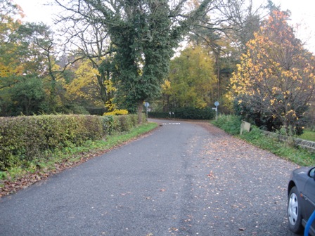
Parking: Park in the lay- by opposite the recreation ground on the road to Stanton in Park. Alternatively there is a small public car park off the A6 on the road to an industrial estate; the road is just before the bridge over the Wye on the Matlock side.
The Walk
The start didn’t bode well. We were going to walk first to Darley Dale but my map didn’t show the concessionary path and it was not clear where it started. On reflection we were on the right road and close to the path but hadn’t walked far enough down the road. Still it is best to walk the route anti-clockwise as the last part of the route is quick, easy to walk and route find.
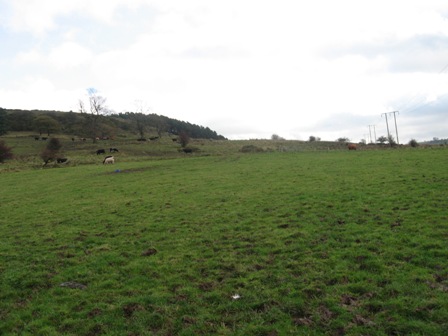
There was little wildlife with the exception of the casual rook, crows and kestrels. In contrast the autumn colours were special. The larch was now falling and the beech, chestnut and oak were brown, yellow and red. Wonderful. The views were not as good as they could have been because of the rain and haze.
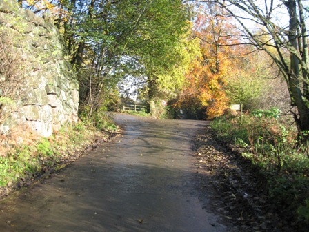
Still, let’s start from the Recreation ground by the lay-by. Walk back towards Rowsley. As the road bends sharp left, turn right on a metalled road to Stanton Woodhouse Farm (FP Stanton Lees).
The walk down the road was lovely with the surrounding woods in their autumn colours.
You know you’re at Stanton Woodhouse because the road ahead to the farm/hall is private. Continue on the road which turns sharp right and then left and tracks above the farm (on your left) and in front of a row of houses. The map says go straight through the farm!
Continue past the houses
Go through a 5 bar gate and take a track that starts to climb up towards Endcliffe Quarry and a surprise.
The track passes through a gate and when it divides at a rock take the left hand path – marked on the rock.
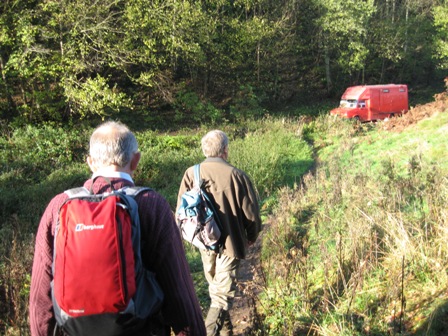
The path goes through a pedestrian gate, along the top edge of a quarry and the top of a wood up to a road – Lees Road. At the gate was a notice objecting to the development of a quarry in the area. In the woods were tarpaulin houses – swampy and his friends the objectors to the development. On the road were a jumble of vans and buses, full to the brim with belongings and not looking too roadworthy. As we approached the vehicles an alarm was going but nobody turned it off. A protestor got into a van and started it up; it spluttered into life.
At the road turn right and walk up the road.
In 400m as the road divides take the left hand road which climbs and bends round to the left. Above, on your right is View Quarry which despite the map saying its disused was being worked. A lorry with a massive lump of stone on its back came down the narrow road.
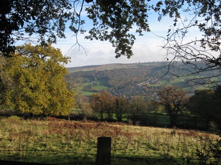
The views from the road looking back to Rowsley were lovely in the autumn colours
After the bend take a path off left (FP) which climbs up to a wood. The map says the path climbs through the wood, but a good path skirts round the boundary wall of the wood, on your left, and climbs to another wall. Here, turn left, cross the wall into the wood and immediately you hit a path.
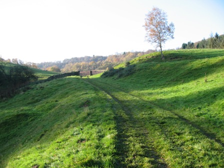
Turn right and follow a good path that takes you along the edge of Stanton Moor overlooking the Wye Valley. The views are good.
The path follows the line of a fence – keeping Swaledale sheep off the edge – on your rhs, passes a tower on your right and eventually, at a corner is a large wind eroded stone which has initials chiseled all over it from various bygone ages.
Continue following the fence until the path begins to descend. Here take a track off right that crosses the fence (notice board) and heads upwards to another track. We caught a couple up who asked us whether we knew where we were and where Nine Ladies Stones were. I pointed in there direction and he said correct.
So right you go and cross Stanton Moor, pass into a wood and shortly ahead is the stone circle.
The stones were said to be ladies who were turned to stone after they were caught dancing on a Sunday. There would be a lot of stone circles in today’s climate.
From the circle, follow the path left which passes along the edge of a wood.
It crosses a couple of fields until it hits Lees Road (FP).
Turn left onto Lees Road and drop down, down no down into Stanton in Peak. This is a lovely village built from stone. Drop down through the village, past Stanton Hall, the church and along the road and out of the village. As we passed Park Farm eight range rovers came up the access track from the Farm and turned right onto the road. Clearly they were a shooting party, looking grumpy and off to another shoot. We heard them later. The road drops down to the B5056 Rowsley/Winster road.
At the road junction, cross the road and take a path (FP) that initially climbs up the edge of a wood (on your right), across a field, past a building and to a road (FP). On your right is Harthill Hall – it looks nice.
Turn left along the road.
In 200m turn right (FP).
The path walks through a caravan park – the way is clearly marked; the park was closed for the winter and looked as if tumble weed should be rolling through it.
From the far side of the caravan site drop down to the bottom right hand side of a field and there follow the line of a wall, down through the bottom side of another caravan site to a road.
Turn right and drop down into Alport village and Lathkill dale.
Cross the river and immediately turn left.
Walk up through the village with the river on your left. In 200m the road turns right climbs up to a road – Alport to Youlgreave.
Turn left and immediately turn left down a track with the river Bradford on your right. This is the start of a lovely couple of kilometers walking down Bradford Dale.
The first section walks past limestone cliffs, weirs and past a lovely stone footbridge and crosses the river before outturning at Mawstone Lane.
Cross the lane and take a track that tracks the right hand side of the river (northern side).
Continue on the track past weirs until after 0.5km you reach a footbridge across the Bradford below the village of Youlgreave.
Cross the river using a fantastic stone footbridge, turn right and follow the southern side of the river for approx. 1.5km until you reach a fine stone bridge just before Middleton. The river here is full of weed.
Cross the river, turn left and follow the bottom side of the river basin. You pass the point where a stream comes out of the limestone to form the river.
Shortly you cross to the top of the river basin and climb some steps to the top – northern side – and then turn right and track the valley bottom until the path divides.
Take the right hand path which drops down and crosses a stream in the valley bottom via a footbridge.
The path now heads south through a number of fields .
After 0.75km you reach the end of a walled lane. Turn left and go straight (FP).
The path climbs with a wall on your right hand side. The field is very wet. As you climb you come across overhead power cables. The path follows the line of the cables – there isn’t much of a path.
The gradient levels and then you come across a 5 bar gate.
Through the gate is an old walled track which takes you down to a lane.
Turn left and climb up the lane until it takes a sharp left.
Here go straight along the lane to Rock Farm; and more Alpacas. Walk past the left hand side of the farm and continue along a path on the lhs of a wall, through the bottom of a wood and two fields.
Anthony Hill is ahead of you.
At the far side of the second field a path joins from the left.
The path tracks below the rocks of Anthony Hill to Cliff Lane.
Continue down the lane and in 200m take a path off left that crosses two fields.
The path exits the second field at its top left hand corner by a farm (Well Street Farm) and some farm machinery (FP).
Turn right down a lane that takes you to the heart of Elton Village by the church.
Turn right and at the far side of the church turn left down a footpath (FP). The path goes along the back of houses and into a field. Cross the bottom of a field, with a wall on your right.
At the far side of the field go straight across the wall and then climb through a number of fields.
After just over 0.5km you reach Dudwood Lane.
Turn left and walk up the Lane for 0.4km.
Just past a building on the rhs, take a footpath off to the right (FP).
The path crosses a field to the B5056 Winster/Rowsley road. Cross the road.
Take a path that crosses a field and then tracks up the walled side of a second field – wall on lhs- to a barn with a sheep and donkey in it! From here a track contours round the hillside until in 0.25km turn right (FP) onto a path.
The path contours round the side of a hill to Rocking Stone Farm – on your left.
Continue straight and follow a wall on your rhs along the top of an edge above Birchover Wood to Birchover Lane. Cross the lane and take a path that goes through Upper Town Farm to Clough lane.
Turn right along the lane. You can make good progress on the lane. After 1.25km the lane enters Clough Wood .
The track descends through the wood until you hit the entrance to a works on your left.
Continue straight down Oldfield Lane, past Bridge Farm until you hit the B5057.
At the main road turn left walk through Darley Bridge and cross the Derwent.
In 300m, at the far side of a cricket pitch, turn left on a path (FP) that tracks the lhs of a wall.
Eventually the path crosses the wall (FP) and crosses a field to a road. Turn left down the road and in 100m as the road divides by a church turn left down a lane past a school. Just past the school you go through a gate that takes you down and past Abbey Farm. As the track bends to the right go straight through a 5 bar gate (FP).
Through the gate the path follows a number of fields until it outturns at Northwood, just past the Peak Railway sidings and station.
Continue straight along a wide access road that used to be the old railway track. The roadway finishes at a small roundabout at the end of light industrial buildings. Go straight across the roundabout onto a concessionary path (FP) which takes you into a wood. The path, which was wet and muddy, tracks the A6 on your right and the Derwent on your left.
In just over 1km the path hits the bottom of an access road to light industrial units.
Go straight and walk up the road to the A6.
Here turn left and cross the river and take the first left (signposted Stanton in Peak). The road passes a school, the kids were coming out, and bends round to the recreation park and the layby with the cars.
Summary
An interesting walk. It was wet from Darley Dale but before this the day was sunny and the temperature warm. There were surprisingly few people out. An old couple on Stanton Moor and the usual couples in Bradford Dale. The paths were muddy
The route finding is straight forward if somewhat fussy. It uses well marked paths, tracks or lanes. There are some nice views and interesting features i.e. Nine Ladies Standing.
Home Start Point Peak District Books Related Sites Text Only Map&Summary
Home Start Point Peak District Books Related Sites Text Only Map&Summary