BirchinGrainWaterGrainStoneBleaklowHeadBleaklowStonesWestendAlportCastleOysterBirchin
22nd May 2009
Peat Moors, Stones and a fine valley
Who: PNO
Weather: Low cloud and rain – all day
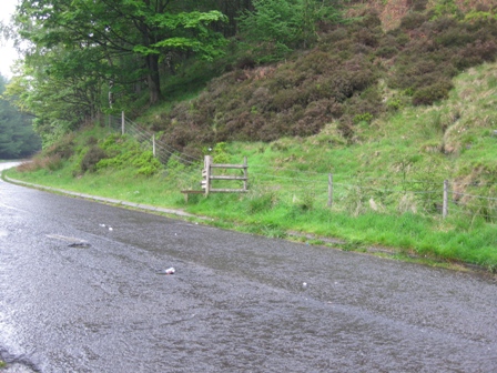
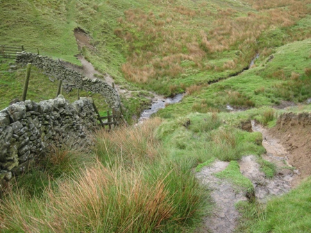
Parking: The layby off the A57 by Birchin Clough. It’s free but there are no facilities.
The Walk
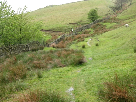
From the northern (top) side of the layby cross the fence via a stile and ascend the side of the moor. For the first thing in the morning it’s a steep climb that gets the old heart racing. The path is good and easy to follow; it climbs through heather and some bushes and trees. Occasionally there are steps cut that are supposed to make the going easier; but they are well spaced and don’t help much. Eventually you leave the tree line and are left with lush green bilberry covered moor.
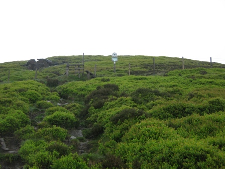
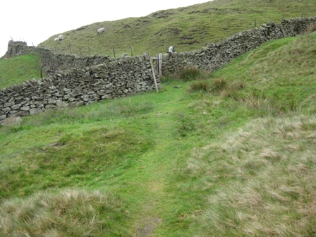
Towards the top of the steepest part of the ascent you cross a fence via a stile (NT sign Alport Moor). The views looking back down Lady Clough are lovely even in the mist and rain.
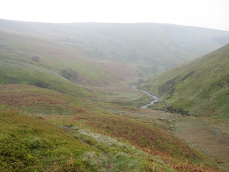
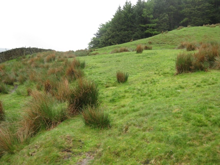
Soon the gradient eases and you leave the bilberries behind and are left with grass covered moorland. The path is good and heads almost due north to the top of Alport Moor, through the coll between Nether North Grain (on your left) and Upper Reddale Grain (on your right) and on to the top of Over Wood Moss. Here the path bends left heading north west, crossing the top of a clough (where you loose the path). Keep heading North West and eventually you hit the path that runs along the top western edge of the Alport Valley.
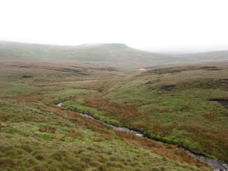
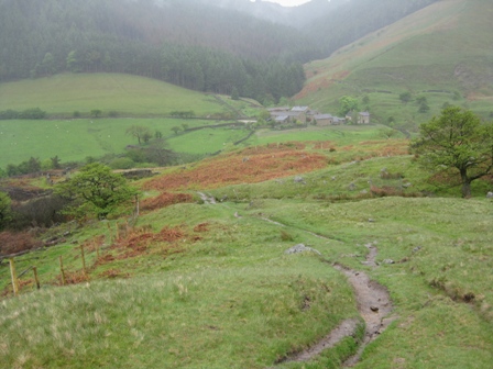
Ahead you can see Grains in the Water. At a convenient point drop down to the Grains and cross Hern Clough and then the River Alport so you are on the eastern bank.
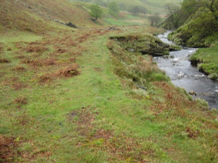
A good path climbs up the eastern bank. Ahead was an orange circular container about 6ft high and 20ft in diameter. We had a number of guesses as to what it was – an alien space ship, an environmental study but close by there was a sign explaining it was a temporary water container that was filled by a pump and pipe linked to the river. It is used by helicopters to fill buckets of water which they drop onto moorland fires. A first for me but a good idea in anticipation of moorland fires in dry summer conditions. There was no sign of this today.
As you walk up the river Near Fork Grain joins from the left.
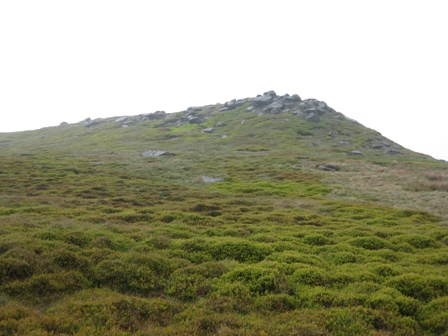
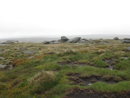
Just above this junction we crossed the river and climbed up towards Grain Stones, crossing a fence via a stile. We ascended to the top on the left hand side of the Stones.
As usual the views from the top were limited by the weather.
From the Stones head up the left hand side and contour round the top of Near Fork Grain and head for Fork Stones.
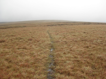
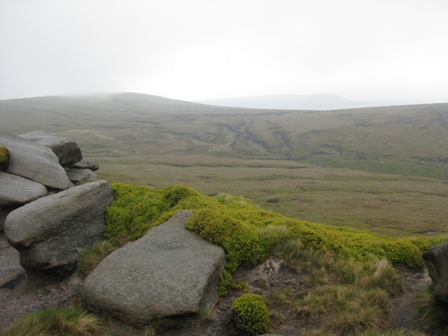
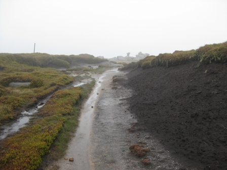
In clear weather you can see the Stones, but today the visibility was poor and could only see them when we were there. From Fork Stones take a bearing of just north of west and head off across the peat moor. The section to Bleaklow Head has been re seeded and is now well grassed.
300m after leaving the Stones you should come across the boundary stakes that cross Bleaklow from Bleaklow Stones in the east. As you approach you should see a couple of large stakes on the near horizon. Then look for a smaller stake and further on a very small stake surrounded by half a dozen stones. Carry on the same bearing and climb towards the large stone cairn topped by a large stake that marks the summit of Bleaklow Head. On a good day you can see the large stake but as normal visibility was poor so you only saw the cairn when you were on top of it.
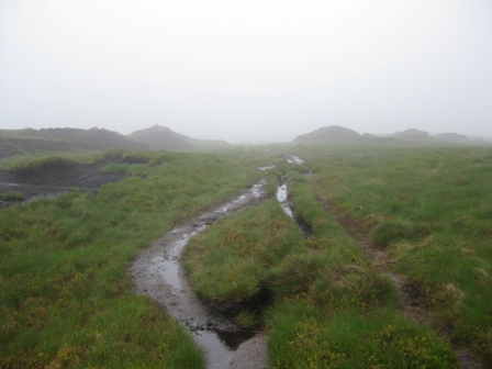
From Bleaklow Head the next objective is Near Bleaklow Stones which is 1.8km away on a bearing east of north east. In bad weather you will need to use the compass – as today. Initially there is a path which soon heads north down Near Black Clough.
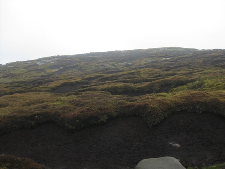
We however, continue on the bearing and circumvent the top of the clough across peat groughs.
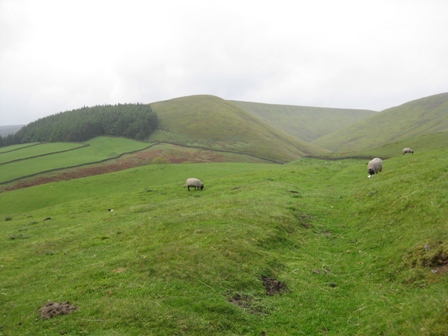
Eventually you leave the groughs and cross sandy moorland to the Stones which are scattered along the edge of the plateau. As we approached the mist lifted temporarily and we were presented with watery views of Bleaklow Stones, Barrow Stones and beyond.
From Near Bleaklow Stones and head south east for Bleaklow Stones. It’s easy going at first.
But as you approach the Stones there are groughs that need to the crossed and sometimes it is easier to head up the groughs to the boundary stakes that cross the plateau.
At the stakes turn left and walk up to the distinctive anvil stone of Bleaklow Stones. I’ve been there a dozen or more times and for the first time found rocks with graffiti chiseled into it. It’s easy to miss things.
From Bleaklow Stones go east to the first stake then head due south down the side of the plateau.
Pick up a grough and follow it down Westend Head, where the grough divides take the left hand grough.
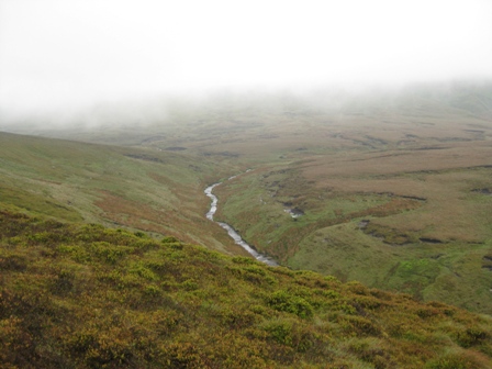
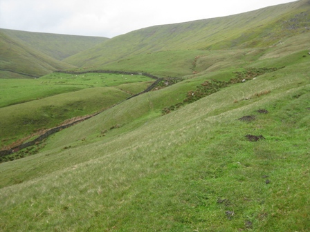
Eventually you hit the main grough which is the river Westend. Turn left and descend down the Westend River.
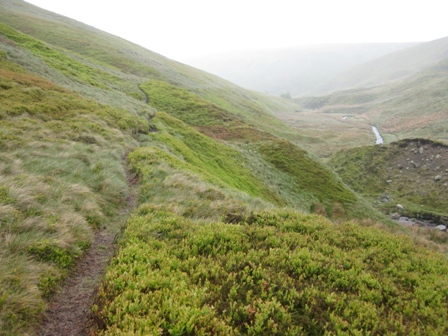
It’s a lovely descent, no path but relatively easy terrain. It’s isolated and as you descend the grough becomes a valley with grassy sides and the valley becomes deeper and steeper. A couple of groughs join from the left and the stream becomes an infant river.
Eventually you cross a fence and as you turn a corner and suddenly the valley opens up, you pass the remnants of a weather gauge which monitored the rainfall so they could correlate it with the level in the reservoirs and then you cross Deep Grain coming from the right.
The path tracks down the left hand side of the valley bottom. Westend valley is a lovely place. Few people venture up here because there is no public footpath marked of the map. But there are paths and it is a place to visit. After 1km Ravens Clough joins from the right in an area just below where there have either been landslips or the line of the river has changed leaving humps of round topped land in the valley bottom.
After Raven Clough the path drops down to the river at Grinah Grain, which joins form the left. Shortly after the Grain we had lunch behind a wall. We were below the cloud line but the visibility was not good because of the rain. As we finished lunch the rain came down like stair rods. Very pleasant!
After lunch we continued down the valley path crossing two fences before the path eventually hits the shooting track that ascends the valley onto Ronksley Moor. Turn right and walk down the valley on the shooting track. You cross a couple of fences via 5 bar gates until eventually just before you hit the river you turn left down a path and cross the river using a wooden bridge with a nesting box under the centre of the bridge.
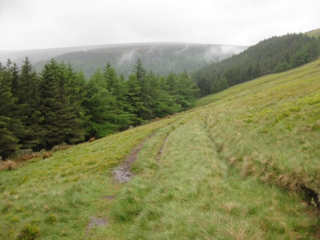
On the far side of the bridge turn left and walk down the track. It’s easy going and even in the rainy conditions it’s always a pleasure to walk down through the wood with the river babbling below you on the left. In 1.25km just before the track crosses Ditch Clough turn right up a track that climbs up through Ditch Clough Plantation (PNCFS Alport Castle).
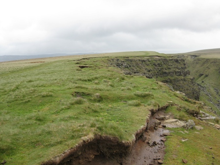
It’s a good climb up through the plantation. In 0.5km you leave the wood through a 5 bar gate (NT Birchinlee Pastures). There are good views to the right of Fagney Clough. The track continues to climb over grassy moorland and eventually tracks the line of some well made shooting butts. After 1km the gradient drops, you leave the butts behind and join the line of a broken wall which leads to the eastern edge of the Alport Valley. In front of you is Alport Castles, claimed to be formed by the largest landslide in England. It’s an impressive place with good views up to Bleaklow (in the distance on your right), across the Alport Valley to Hope Forest and down the valley to Kinder, Win Hill and beyond. Today we could just see the Castles.
Turn left and walk south east on a grassy track down the valley edge. Ahead you can see a path heading down on the far side of the Castles and 0.5km from hitting the Alport Valley edge, turn right down the path that descends down the valley side to Alport Castles Farm.
You have to be careful to find the path but once you are on it the way is clear. If you miss the path you will hit the line of a wall. Look down the valley side and you will see the path and you can drop down to it.
Initially you follow the line of a fence/wall (on your right), which you cross (the wall is now on your left) and then cross again.
After the second crossing you follow a fence down (on your right) which turns north and shortly afterwards you pick up a fence on your left which marks the boundary of Castles Wood. Continue to descend. The gradient gets steeper after a P&NFS sign. Eventually you reach a track, which you cross, and drop down to a footbridge across the Alport. On the far side turn right and track the river until the path climbs up to and crosses a fence.
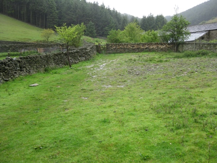
The path now heads to a gate in a wall on the lhs of Alport Farm. Track round the left side of the farm and shortly a stile gives access to the farm track.
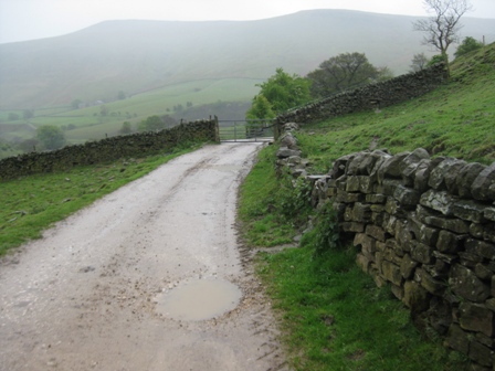
Turn left and walk down the farm track. On your left there are good views of Alport Castles.
After 1.25km you will see a FP pointing to a path on your left and immediately after this a fence comes up from the left and tracks the lhs of the track. Shortly afterwards the track bends round to your right and in front of you can see Hayridge Farm. Immediately on your right take a path at a WM post. The path tracks across a field above the farm to a fence which is crossed via a stile. The path continues to track above the farm to the edge of a field where you turn right and ascend up a gullyed track with a wall on your left.
As we contoured above Hayridge farm PNO reminisced that about the same time a year ago he stopped and talked to the farmer as he climbed the fell on his quad rounding up his sheep and lambs. P knew him. P asked if he was still lambing. Nearly finished he said as the lambs bounced around. They were still bouncing this year.
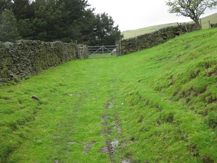
As we climbed up the track in the gully beside the wall a year ago we were faced by a fierce looking black bull in front of us. It wasn’t there this time. The track tops out at a 5bar gate.
The track then tracks round the top of a wood and crosses a clough before heading straight to a wall and tracking the wall (on your left) as it climbs up to a stile (NT The Knots).
The path now follows the right hand side of a wall as it contours round The Knots and Cowms Moor.
At the second wall you cross there is an NT Sign (Cowms Moor). Eventually the wall drops left and down the fell.
You keep straight and contour round the fell side, crossing a fence via a stile as you enter the start of Oyster Clough.
Ahead you eventually see the V shaped valley of Oyster Clough. The path drops down to and crosses a fence via a stile and immediately fords a stream.
Subsequently, it follows a wall (on your left) which drops down, crosses a wall and finally outturns at the stream in Oyster Clough.
Cross the stream and climb tracking a wall on your left. As you climb in front of you is a wood. At a convenient point cut up to the boundary wall round the wood and continue to climb tracking the wood on your left past a P&NFS.
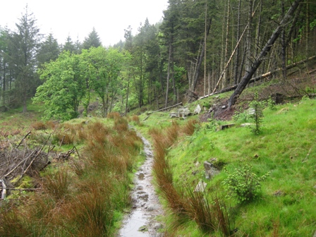
The gradient levels and then as the ground starts to descend the path leaves the wall and descends diagonally down to a stile that lets you enter the wood (NT Alport Moor).
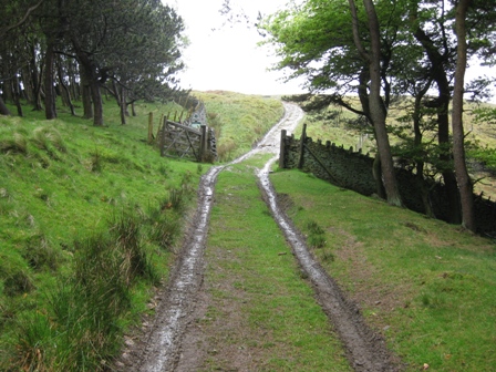
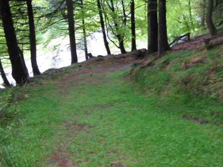
A good track continues to descend through the wood before it splits. Take the right hand path (FP Birchin Clough & Lady Clough) which goes straight tracking the right hand side of an old wall. Shortly it starts to climb and crosses an area where the trees have been felled. The line of the path is not always clear. On the far side a good path keeps tracking the wall climbing through the wood before dropping down to the A57 Snake Road. Don’t cross the fence onto the wall but turn right (FP Birchin Clough).
Climb on a good path through the wood.
After 400m as the path continues to climb look for and drop down on a short path to a stile at the bottom of Birchin Clough car park. You have finished at last.
The second half of the walk is a bit of a drag which wasn’t helped by the foul weather.
Summary
The first half of the walk is interesting as you climb up and over Alport Moor to Grains in the water and up and round the Bleaklow plateau. The walk down Westend Valley is always a pleasure. But the return from Alport Farm was a little boring.
The weather was foul. It rained all day. The only good thing about the weather was that it was not windy. Cloud kept dropping down to below 1500 ft which limited views and made the use of the old compass imperative.
The route is a mixture of good paths and moor trotting on a bearing. Surprisingly there is a good path form Birchin Clough over Alport Moor and up the side of Alport river from Grains in the Water. However from leaving this path for Grain Stones the trek up and round the Bleaklow Plateau and down into the Westend Valley is largely pathless. From there back to Birchin Clough the paths are good.
Bearings had to be taken round the Bleaklow plateau and much to PNO’s surprise we hit our objective every time. Even I was impressed.
There wasn’t much wildlife. A few plovers, the occasional curlew and skylark but no lapwings. Our friend the hares were out and about in their summer coats.
Home Start Point Peak District Books Related Sites Text Only Map&Summary
Home Start Point Peak District Books Related Sites Text Only Map&Summary