KingWestendBleaklowSwainHeadHorseCrowCutgateKing
28th November 2008
A glorious desolate route with wonderful views
Who went: PNO, JH, PH was in the lakes, DG in Canada
Weather: Cold, with sunny periods, but freezing in the shade and cool on top. A fantastic day with hazy views on the tops in the wintry sun.
Parking: Park just down the road from Kings Tree it's free. But you can't access the road after Fairholmes at weekends and on bank holidays. Weekdays are the best time there aren't many people around and today there were none. Perfect.
Wildlife: White Mountain hares, a couple of hovering kestrels and of course the grouse lots of them.
The Walk
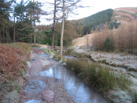
From Kings Tree walk down the road to Cold Corner and then down the road to the end of the reservoir in the Westend Valley .
As the road turns round at the top of the reservoir and over the River Westend, turn right through a pedestrian gate by a five bar gate and take a track that crosses the River Westend via a concrete bridge put in for logging operations. In 30m turn right along another track that takes you up the Westend Valley.
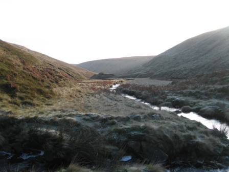
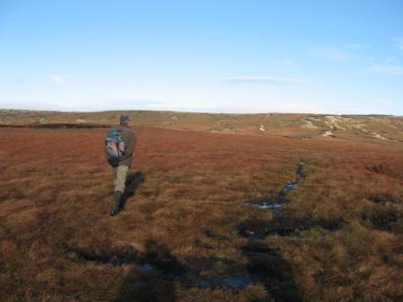
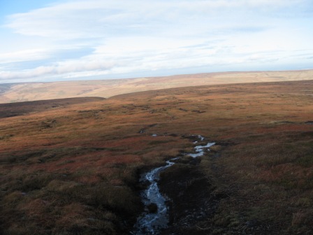
It's a good track and you can make good time. The walk up the valley is wonderful in the wintry sun and the autumnal colours.
After 1 km turn right over a wooden bridge over the river notice says it can only be used for walkers. The track continues on the eastern side of the river.
In 100m it turns right onto a second track which comes up from the river and climbs away from it before bending left and tracking the river just below a plantation.
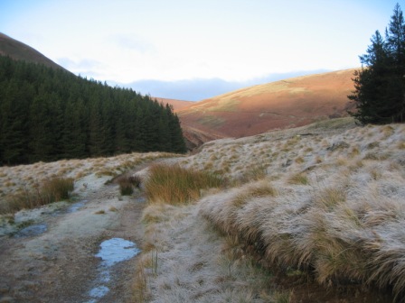
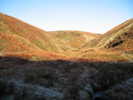
After 0.5km the track leaves the plantation and just before it bends right to climb away from the river go straight and head for a stile that crosses a fence by the river bank. From here a path tracks up the right hand bank of the river. Its an exciting journey up a wonderful isolated valley. People come up here because there is a path. After 0.5km a Grinah Grain goes off right towards Ridgewalk Moor, continue up the main valley. Around here was where Tip the dog stayed with his owner, a shepherd who had died on the moor; a plague to Tips exploits is just above the Derwent Dam wall.
Two paths go from the junction with Grinah Grain, one follows the river, the one we took, the other climbs up the side of the valley and tracks 50m above the valley this is the one to take. As we approached Ravens Clough - off to the left - we climbed away from the river for 100m to the upper path.
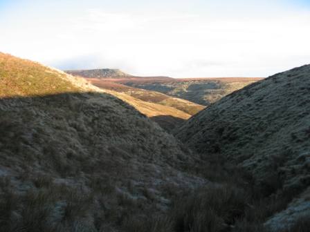
This follows the river for a further 0.75km to the basin of the river. The walk up the river in the wintry sun was magnificent an adjective not used lightly. Half the valley was in sun and warm, the other, in the shade, was covered in frost and cold, very cold. At the basin a major valley goes off right Deep Grain cross this too a point where an old rain gauge used placed. The remnants of the surrounding wall are still there. The gauge was one of a number installed after the dams were built to monitor rainfall so they could correlate with water levels in the dam with the rainfall. They were regularly visited by water board officials. What a fantastic job.
Take time to look back down the valley. Who needs Scotland or the Lakes?
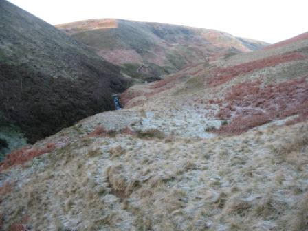
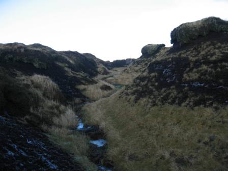
Here the basin splits, take the left hand clough. This climbs steeply in the shade and cold. But look back down the clough as Grinah Stones reveals itself in its full glory. There's not much of a path. This takes you onto the moors at a col just below The Ridge. Close to the col the clough divides, we went straight up onto the fell between the two cloughs.
From here you get magnificent views back to Grinah and across onto Back Tor.
As the gradient drops you hit the distinct path that comes down from The Ridge and down to Alport Castle. At the path turn right and climb up the path onto the top of The Ridge.
Continue ahead to a fence which is crossed via a stile. Here the path is lost, but continue straight and head up the left hand side of a grough which climbs up onto Bleaklow plateau. There is a path from the bottom of the grough.
Towards the edge of the plateau the path drops down into the grough. Keep up the main grough, where it divides, and eventually you will see a stake on the tops.
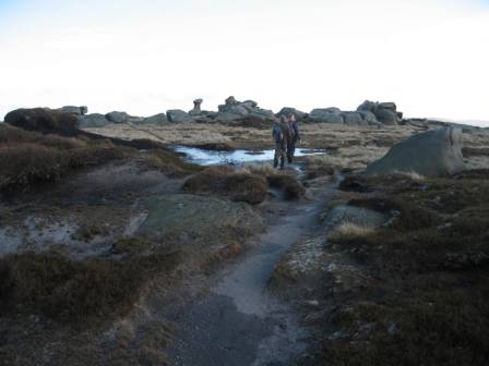
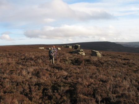
Climb up to the stake and here turn right east and walk along the edge of Bleaklow past a second stake to Bleaklow Stones.
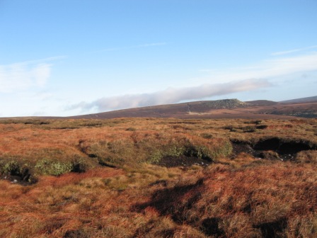
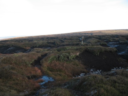
As you approach The Stones look back at Bleaklow, its one of the wonders of the Pennine's; peat hags and groughs a veritable desert of peat and now grass. On the tops the ground was frozen; great because otherwise it would be hard going in the peaty mire.
The views from The Stones are stupendous.
The route now drops down heading north east and following the line of stakes that marks the watershed between feeders for the River Westend on your right south- and the Etherow on your left - north. The stakes are not that easy to see, even on a clear day, as you descend. Don't make the mistake of heading on the path that drops down right this takes you to Grinah. At the second stake a good grough goes off left this is a feeder for Far Black Clough. Initially we took this I didn't look at the map but soon realised my mistake, so we tracked across the top of the groughs until we came across canes and flags; this marks where you turn left north and take the first good grough before you hit the canes.
You soon pick up the stakes again marking the boundary and the route.
As you descend the grough you hit the edge of the plateau and can look down towards Swain Head with Far Black Clough on your left and Swains Greave on your right.
From the edge of the plateau the stakes drop down along the line of a weak sandy bottomed grough. It's a nice route.
Make sure that you follow the stakes because as the gradient levels after ~ 1km, the path turns just north of east and heads for the fence at Swains Head, some 0.75km ahead. It is important to follow the stakes as this marks the line of the path.
You can't see the fence until you are much closer to it. In poor visibility it's not an easy to follow and the ground is always water logged unless there has been a period- long period of dry weather. But once at the fence you need to find the stile that crosses it as this marks Swains Head. From here there is a clear path climbing gently and heading north east to Featherbed Moss. However, from the stile we headed east across the pathless moor to the distinct features of Dean Head Stones.
Its relatively easy going as the heather is short it was burnt last year - but there is no path.
Keep to the top of the Stones; there is an intermittent path sheep tracks which in 500m leads to Shepherd Meeting Stones and Hoar Clough. Cross the Clough and climb up to the top of another set of Stones unnamed.
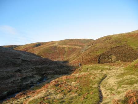
Again the going is across heather moor with intermittent paths. From the top of the last Stones a path starts off heading just north of east that eventually peters out as you contour round the top of Coldwell Clough heading for the distinctive on a clear day Horse Stone Naze, the next destination.
The circumvention of Coldwell Clough is easier than it appears. The top of the Clough is a peaty waste with no deep groughs, more a peat desert. As you track round the clough the route ahead turns south and begins to climb with the stones of Horse Stone Naze on your right. Not many people venture up here and we saw 2 mountain hares in there white winter coats.
Keep close to the edge and as the gradient begins to drop you see the lone site of Horse Stone on your left. Head for the Stone. On a clear day however, go to the end of Horse Stone Naze because the views down the Derwent Valley and across to Barrow Stones are a sign of things to come.
From Horse Stones the next target is Rocking Stones which can clearly be seen on your right east on the far side of Stainery Clough.
A path heads north east which drops down and in 0.8km crosses Stainery Clough before bending round and heading south climbing up to Rocking Stones, 0.5km away. The path goes to the left of the Stones and carries onto Crow Stones Edge.
The view from here is the best of the Derwent valley and to cap it a kestrel hovered in the wind. You look down the valley to the reservoirs, Win Hill and beyond. In the hazy winters sun this is my favourite view in the Dark Peak.
From the edge two paths head off; take the weaker right hand path that gently descends for 0.6km to aircraft wreckage at a line of grouse butts at Broadhead Clough. The path comes out at the top of the wreckage by 6 small crosses. Drop down the grough past the engine wreck to a butt no 8.
From here a path goes off left contouring round the valley side to Bull Stones, some 0.5km away. A path continues from the top of the Stones to Cut Gate End and the main path from Slippery Stones to Langsett reservoir.
The original plan was to descend via Howden Clough but time was running out so we turned right and headed down the path to Slippery Stones. It drops first to the edge of Bull Clough (on your right) which it tracks for 200m before descending into Cranberry Clough.
At the edge take the right hand path, which cuts out a switch back, and drop down to a track going up Cranberry Clough. Here turn right on the track and descend further, crossing Bull Clough. Continue descending down the right hand side of Cranberry Clough for 300m before meeting the track that goes up the Derwent Valley. Here turn left, cross Cranberry Clough on the footbridge, and take the right hand track after 100m that takes you to the bridge at Slippery Stones.
Cross the bridge and climb up to a track which is accessed through a gate. The track follows the western bank of the Derwent, through woods to Kings Tree, 1.25km away. It is a lovely end to a great walk. A walk for a cold clear winter day or a sunny summers day.
Summary
A good walk over desolate moor with some of the best views of the Derwent Valley.
The route finding is not always easy especially dropping down from Bleaklow Stones to Swains Head when the visibility is poor. There are no paths from the Westend Valley onto The Ridge, across the Bleaklow Plateau and around Coldwell Clough. After wet weather the ground from The Ridge to Horse Stone can be sodden and slow you down. But don't be put off because there is wildlife and stunning views (if the visibility is good)
Home Start Point PeakDistrict Books Related Sites TextOnly Map&Summary
Home Start Point PeakDistrict Books Related Sites TextOnly Map&Summary