BunsalCobShinningCat&FiddleDane ValleyTurnEdgeFlashAxeEdgeGoytCloughBunsalCob
27 th June 2008
Ridges, valleys, moors and a three county junction
Who went: PNO and JH. DN waiting for a plumber, DG gave blood the day before
Weather: Overcast day that was cold wore buffalo with the occasional shower
Parking: Park at Bunsal Cob, just before Errwood reservoir. It's free and has a PC. Unfortunately the PC had been vandalized and was closed. In Broad Acres it would be looked after but not in Derbyshire. I'm surprised they hadn't knocked it down.
The car park is beside the road and was deserted as we left for the walk. When we returned it was half full!
The Walk
Turn right from the car park and head down the road towards Errwood Reservoir.
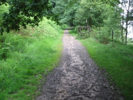
Cross the dam wall and at the far side as the road bends left go straight and climb up a path to a gate in a fence(FP). Turn right through the gate and take a path that tracks the western side of Fernilee reservoir.
The path drops down through a wood to a good track by the reservoir.
In 200m take a path (FP Fernilee ) that climbs up away from the reservoir before contouring along the reservoir bank. It's a very pleasant and popular walk through woods on a good track.
The path crosses Deep Clough via a footbridge then gently descends to a metalled road, that marks the boundary to the wood. At the road turn right and in 100m you are at the dam wall of the reservoir.
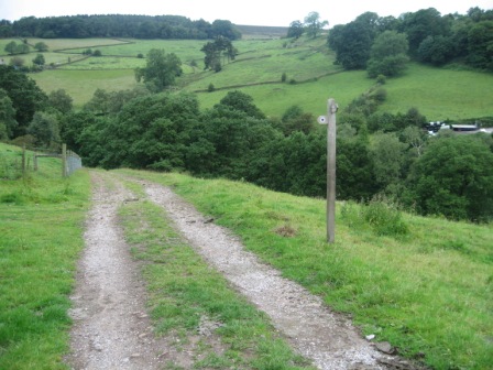
Just before the dam wall turn left on a good track that heads north tracking down the side of the Goyt valley. You can make good progress on the track.
Don't be tempted to take paths off to the left. Eventually the track begins to turn west as it hits Mill Clough don't be tempted to take a track that goes off left - but keep straight and descend down to a bridge that crosses the Clough. You can see where you are heading for as on the opposite side of the Clough is Midscar Farm.
The track climbs up to the Farm. Go through the 5 bar gate before the farm and keep left and climb up the track for 100m to a metalled lane.
Here turn left (FP) and walk up the lane, past Overton Hall Farm to Taxal Moor Road.
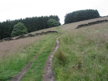
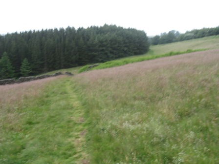
At the road go straight on a good path that climbs steadily up to Taxal Edge. Goyt Forest is on your left. By now the wider views open up across the Goyt Valley and down to Whaley Bridge.
At the top of the climb the path hits the boundary wall of the forest.
Head slightly right along the right hand side of a fence to a farm 300m ahead on Taxal Edge. Just before the farm yard is a 5 bar gate, the path goes through the gate and yard and in front of the house a path goes off left. However at the gate which was difficult to open, we turned left and cut up a track which, in 50m, hits a wall. Here you meet the path from the farm you've taken a shortcut and cut the corner- terrible!
The path tracks up the left hand side of the wall.
Ahead you can see Wingather Rocks and to the left and right for the next hour and half you have excellent views over towards Manchester and the plain of Cheshire, on your right, and the Goyt Valley and towards Buxton on your left. The path crosses a stile at Wingather Rocks and then continues north to a road. As we walked past the Rocks children's voices could be heard above the wind. Two transit vans were unloading helmeted kids who were about to experience their first attempts at rock climbing!
When you hit the road don't cross the wall but keep to the path to the left of the wall. This tracks the road up to Pym Chair.
As you approach Pym Chair you hit a fence, take a path that goes off left away from the road. This path bends round and hits the road from Errwood Reservoir to the left of Pym's Chair.
Cross the road and take a path (FP) that hits the ridge at a wall.
We had a rest and took in the view. It's worth spending a few minutes here as you can see planes landing at Manchester Airport and the Jodrell Bank telescope. On a clear day I've no doubt you can see the mountains of North Wales.
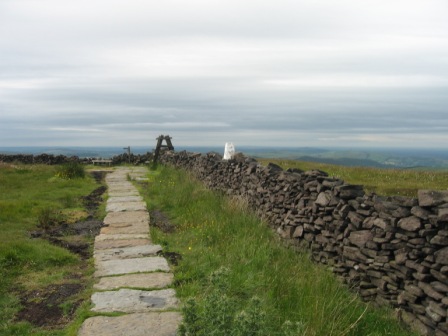
At the wall turn left and track it along the ridge past Cats Tor, the Tor to Shining Tor.
The path is popular and is paved in parts to help prevent erosion. The moors had clearly been covered in cotton grass but the recent rain had drowned the grass and it was past its best.
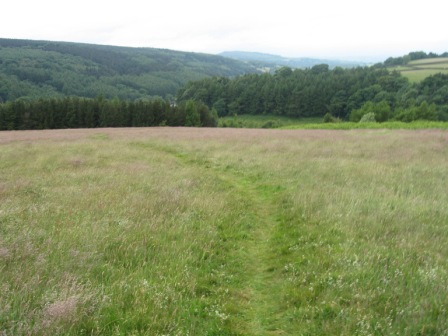
From the top of Shining Tor turn left (FP) and head south east along a good path with a wall on the right. The path drops down to a col at the top of Shooter's Clough then climbs to the top of moor where it meets a track coming from Errwood Reservoir. From here you can see the Cat and Fiddler and its distinctive aerial and building complex in the middle of nowhere.
Turn right on the track, which heads almost due south, and in 1km you hit another track just before the A537 Buxton to Macclesfield road.
Turn left at the track and in 250m you join the road (FP). Turn left and walk up the road to the Cat and Fiddle.
As you hit the pub take a track that goes off right from the start of the car park on land opposite the pub. The track heads almost due south contouring round the moor.
In just under a 1km the track turns south east and drops down Danebower Hollow to the A54 Buxton to Congleton road. Watch out for aging bikers who have a habit of crashing bikes on the road.
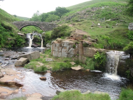
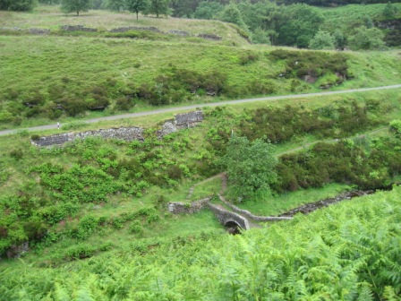
Cross the road and the crash barrier via a stile and descend down the valley side, by a very nice stone chimney, to the valley bottom. The area is a complex of two quarries Danebower and Reeve-edge which are on the opposite bank. This is the top of the Dane valley.
At the river a path descends down the western side to the pack horse bridge at Three Shire Head.
Three counties meet here Derbyshire, Cheshire and Staffordshire. It's very picturesque which is why we had lunch on the bank of the river. BUT the atmosphere was spoilt as four trail bikes noisily appeared along the track we were about to take. Pity.
Cross the bridge and turn right taking a good track that climbs away from the river below you on your right and taking you round the Turn Edge.
In front of you the Roaches appear on the skyline. A subject of another walk. The track turns eastward round the edge and passes a building with a track coming up to it from the right. Walk past the building and in front of you the track divides, take the right hand track that keeps on straight.
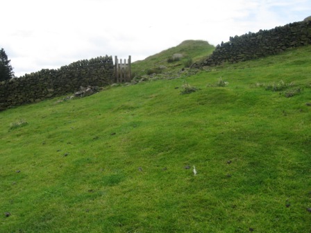
At the second track coming up from the right (there is a way marker post) turn right down the track and in 50m turn left off the track to the left of the buildings at Wicken Walls where a small gate gives access to a field.
Turn immediately left and track a wall on your left. In 100m cross a wall via a gate and go straight descending down towards a stream.
A footbridge allows you to cross the stream and a path climbs up steeply taking you out of the clough.
The path tracks left to a wall and then climbs up the left-hand side of the wall across three fields until you hit a track leading to Axe Edge Green Farm. Turn right amd walk along the track for 50m turn before turning right on a path that climbs up steeply to a road (FP).
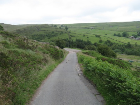
There are good views looking back down the road. At the road turn left and climb up to the village of Flash.
A road sign announces that it is the highest village in England at 1518ft above sea level. AW always told me Taddington was the highest village but checking the map showed it is 200ft lower than Flash. It's a steep climb but eventually buildings announce that you've reached the village.
At the first houses on the left turn left (FP) and walk in front of the houses on a track that takes you to the left hand side of the last building. Through a five bar gate, at a waymarker, turn right.
Climb up through a field on a path that takes you to a stile in the middle of the top wall of the field. The path then tracks over to the top left hand corner of the next field before diagonally crossing to the left hand corner of the next field, where you join a walled tack via a gate.
Turn left and walk up the track until you hit the remnants of an old wall.
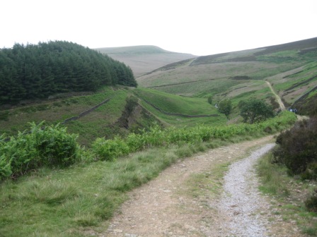
The path now tracks over grassy moorland.
Eventually it descends down to the left-hand side of the buildings at Oxenditch (FP). Here you turn right along a metalled road. In 50m you turn left on a road that climbs up to the village of Hilton. There are two Grundy farms with wrecks and large beams on either side. PNO had been directed there to purchase some old slates for his roof. After the farmer had asked for £10 for the slates and PNO had started to barter, the farmer told him they were £10 and he could F Off if he didn't like the price. P was so annoyed he left the miserable old bas . because of his attitude. He actually paid more for the slates elsewhere!
Continue past the farms and in 200m where the road splits take the left hand road and climb up to the houses at Axe Edge End. You are welcomed by a sign that says private property.
Straight ahead is a pedestrian gate that gives access to a track down the left hand side of the buildings. The track contours round the western edge of Axe Edge heading north. In 0.5km the track bends left at a gate towards a farm. Go round the right hand side of the gate and as the tracks bends left continue ahead on a path heading just west of north.
The path crosses the valley above the farm and climbs up onto the top of the western side by some rocks. There good views open up across to Shinning Tor. The path continues west of north dropping down to a track.
Turn right along the track which in 400m turns east and shortly hits a metalled road.
Turn left at the road and in 100m, as it bends left, a path (FP) goes off straight and takes you onto the top of Axe Edge Moor where you join another path coming from your left.
Turn right on the path which in 0.6Km drops down to the Buxton/Macclesfield road.
Cross the road, minding the cars as it's a busy through route, and take a track going straight which in 1.5km hits a distinctive walled track climbing up the fell-side from Buxton.
Turn left and immediately right (FP) and continue along the top of the ridge for 0.5km.
At the junction with a path from the Goyt Valley to Burbage (FP) turn left and drop down the southern side of Berry Clough. After 0.4km the path crosses to the northern side of the clough then continues to descend to the valley bottom at the junction with Goyt Clough.
Here the path turns right (nb Don't be tempted to cross a footbridge to the road and walk down the road to the car)and tracks down the eastern side of Goyt Clough.
The path continues until you are opposite Goytsclough Quarry; below you is a footbridge. Continue on a path that tracks down the valley. After crossing a wall the path hits a second wall and after crossing it the path contours round the end of the fell with the wall on your right hand side.
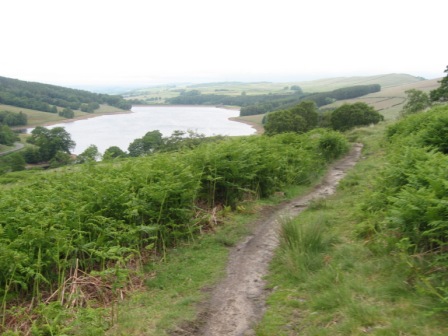
The views down the valley to the reservoir at lovely.
The path turns into a track and follows the line of Wildmoorstone Brook to a bridge which allows you to cross the brook.
Then turn left and walk back down the northern side of Wildmoorstone Brook on a good track until it hits a track descending down the fell side. At this junction take a path goes off diagonally right (FP) and tracks along the top of a wood before tracking along the bottom side of a field by the side of a wall.
After crossing another wall the path ascends and cuts through a wood before tracking the bottom side of a further wood
The path then diagonally crosses a field to its top left hand corner, contours across the next and in the next field take a path that goes off left and heads for a gap in the wood that circles the bottom of Bunsal Cob.
A short stiff climb the steepest but shortest of the day - takes you up to the top of the Cob. The view of the valley is worth the climb.
Continue ahead across the flat top of the Cob before descending down the far side, through the wood and back to the car park.
Summary
A good walk in cool conditions with nice views of the surrounding fells, valleys and of Manchester and the Cheshire plain. The highlight was the views from Pym Chair and of the Dane valley at Three Shire Head. The downside was the motorcycles in the Dane Valley.
Route finding was straight forward and the paths were generally in good condition
The cotton grass on the high fells was past its best and there was lots of bird life both on the fells and in the valleys.
Home Start Point PeakDistrict Books Related Sites TextOnly Map&Summary
Home Start Point PeakDistrict Books Related Sites TextOnly Map&Summary