Kettlewell Yockenthwaite HorseHead HaltonGill Arncliffe Kettlewell
25th January 2008
Two Magnificent Dales and Fine Views on the Tops
Who went: DS
Weather: The 2 weeks before had been wet with some flooding. In fact we had been going to the Dales but DS called it off because the forecast was for rain. I went into Derbyshire.
The day started well but turned out rather different as we crossed a weather front. Then all hell broke lose. As we climbed up to the top of Horse Head Moor the winds were blowing a gale the A66 was shut to high sided vehicles and by the time we returned home the A1 was shut around Wetherby and north of Dishforth because of overturned lorries. So instead of Wensleydale and Cam High Road we headed for heaven and Wharfedale and Kettlewell.
The day was grey we left the sun behind
Parking: The car park at Kettlewell costs £3.50 per day. There are cheaper options but the money goes to the National Park. There is also a toilet.
The Walk
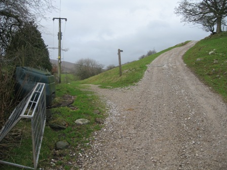
Leave the car park by the southern end and walk down the road back towards Grassington. Cross the bridge over the Wharfe.
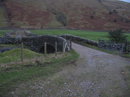
Immediately turn right up a track and right again through a gate (FP Starbottom).
The path follows the western bank of the Wharfe. It's a wonderful river. Today it was swollen, after the recent rain, full and fast flowing. The path to Starbottom and onto Buckden is easy to follow. It's always within 100m of the river and follows paths and tracks, some walled. Where there are issues the way forward has FP indicating the way.
Initially the path follows the river but soon it moves away from the river bank going down a walled track.
Eventually the walls go and the track crosses fields before following the line of a wall.
Eventually the path goes through a gate and ahead is a closed gate behind which is a barn; you don't go through the gate but instead follow the line of a fence, which is on your right, until you are met by the wall coming from your left.
The path cuts across a meander,
crosses a stream via a planked bridge before cutting across a second meander.
Subsequently, the path follows the river bank for 300m until the river takes a sharp right.
Here the track drops down and crosses the flood plain before regaining the line of the river.
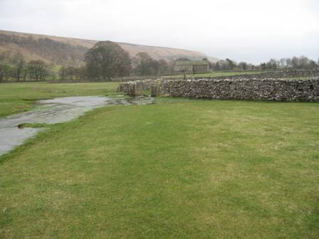
You track the river bank until you reach an excellent FB over the Wharfe; this gives you access to the lovely village of Starbotton.
All the way up the river the weather had been clear but you could clearly see the tell tale signs that there had been extensive flooding on the flood plain. Flotsam was up to 100/200m either side of the river course which must have been 3m above the normal river level. We couldn't have walked the route with this amount of water. Today it was wet underfoot but not as bad as Derbyshire; there was not too much mud.
By now the sun was out and there were great views down the valley. Ahead the weather looked grim and grey
From the footbridge, the path follows the river bank for a further 500m before the river meanders away to the right.
The path carries on straight following the rhs of a wall; occasionally there were walls on both sides of the path.
0.75km after leaving the river the path crosses Step Gill via a footbridge before continuing up a walled track.
At the end of the walled track you cross a couple of muddy fields before joining a track from your left (FP).
Go forward along the track which tracks below Birks Wood.
After 0.4km turn right off the track (FP) down a good path which drops down to the river.
The path now follows the line of the river bank.
Eventually it hits the Buckden to Hubberholme road just after Buckden Bridge.
Cross the road and continue to follow the river bank.
After 1km the path continues straight, as the river bends right, and comes out onto Dubb's Lane 0.7km east of Hubberholme.
There were watery views up the valley. Highlighting the challenges to come
Turn right and walk up the road to Hubberholme.
The road was wet an ominous sign. As you walk up the lane you pass Kirkgill Manor on your right restored in 1893 by Bishop Heber! Eventually you hit The George Inn. Here turn right down the road towards Stubbing Bridge and onwards to Cray. Cross the bridge over the Wharfe; ahead is Hubberholme Church where JB Priestley's is buried. The church has mousy Thompson pews.
At the far side of the church turn left up a good track (FP). The track bends round the back of the church and eventually divides.
Take the left hand track (the right hand track climbs up to Scar House) which follows the line of the river for over 2km until it hits the small hamlet of Yockenthwaite.
As you walk up the valley the wide bottom of Wharfedale becomes more enclosed and the true magnificence of the Upper reaches of the Wharfe becomes more evident. Halfway to Yockenthwaite the waterproofs came out as we hit the weather front. At Yockenthwaite the path outturns at the access track to the farm. Here turn left and walk down to the valley road, turn right and cross the bridge over the Wharfe.
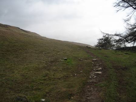
On the far side of the bridge continue on the road heading for the hamlet of Raisgill. Just before you reach the hamlet turn right on a path that climbs up to the main track to Halton Gill. This track starts at a wall (FP Halton Gill). There is also an improbable sign banning motor vehicles and bicycles. No car could reach the sign. The path climbs by the side of a wall and in 50m it bends sharp right and continues to climb on a good track. In a further 100m the track bends left and marks the start of a good climb up the top side of Hagg Beck and onwards up to the top of Horse Head Moor. At the bottom of the climb the track zig zags up the side of the fell. However, there are paths that cut across the bends. Eventually the track hits and follows the top side (north) of a wood. After 0.7km the gradient weakens and Hagg Beck bifurcates. The path crosses the right hand branch and climbs to the top of the Moor. As we climbed the wind got stronger and was in our faces. I estimate it added 20 degrees to the slope. Needless to say the dog was behind me grappling with the turbulence!
As the gradient decreases you hit the wall that runs along the top of the fell. To your right (north) is the trig point of Horse Head and to the left 4km away is Birks Fell. In front of you is Plover Hill and Pen-y-Ghent and Darnbrook Fell. Behind you is Fleet Moss and Yockenthwaite Moor.
Cross the wall at Horse Head Gate and from here a good track starts the descent into Littondale. Initially the track heads south west before descending down the western side of Halton Gill Beck. As you descend the hamlet of Fox Up and halt on Gill come into view. The track is slippery in wet conditions and of course I slipped and ended up on my rump! That doesn't happen very often. To the NW of Halton Gill the track bends sharp left and meets a track from Beckermonds which joins from the right (FP) nb the dog thought the FP said Hawes not Beckermonds; his eyes must be going. Turn left and drop down on the track to the road just before you enter the hamlet.
Halton Gill is an old hamlet and is idyllically situated at the top of Littondale. The only problem is that it is dry. We had lunch on a bench by the parish hall. It was dull, windy, miserable and damp. No one was about. I said to the dog You could murder someone here and no one would know'. Interestingly it was a neighborhood watch area. As we munched on our food a farmer opened the gate opposite from where we sat and came towards us. Wish I'd known you was here' he said. I was up on the barn roof and the ladder slipped. Didn't shout casue no one was about and Alison wasn't due back for another 3hours. The remembered there was a window at one end, so I leant over and pushed the window in. Slowly I lowered meself down, hung from the concrete gutter and dropped into the window. Wish I'd seen you two'. He had a bright red face, puffy big hands in which he held a hammer which the shaft had clearly broken and he'd forced the head back on.
Walk through the hamlet, past a red telephone box, which must be one of a few which still manages to have a phone directory in it. As you leave the village turn right on a road over the fells to Stainforth and cross the Skirfare using Halton Gill Bridge. On the far side immediately turn left just before a barn and walk down a path that tracks down the bank of the river with a wall on your right. After 300m the wall and path bend away right from the river.
After crossing 4 walls and 0.5km further down the valley the wall on your right takes a sharp right and goes up the valley side.
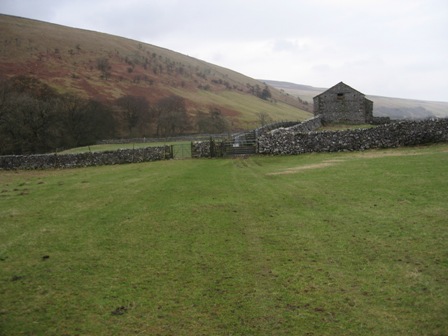
The path carries on straight crossing 4 fields each with a barn typical dales valley features. After the last barn the path crosses a further two fields.
Then after crossing a wall a track goes off right to the farm at Nether Hesleden but the path carries on straight (FP) to a further wall.
After crossing the wall (FP) turn right and track the wall to farm track. Turn left down the track and in 20m turn right through a pedestrian gate.
Walk to the top left hand corner of the field, crossing 2 planked streams. A stile gives you access to the main farm access track (FP Silverdale Road / Litton). Turn right and walk up the track to a 5 bar gate.
Through the 5 bar gate there is a compound of geese. They certainly hiss and make it clear you are not welcome. It's a good job that they are contained by a fence as they are large aggressive animals. At the 5 bar gate turn left and walk down the side of a wall towards Pen-y-ghent Gill.
At the bottom of the field turn left through an old wrought iron gate and then immediately right and cross the Gill via a lovely stone bridge. On the far side cross a fence via a stile by a 5 bar gate and turn left (FP Litton).
The path follows the line of the Gill (on your left) through 2 fields. There are always two friendly miniature ponies in these fields that invariably follow you to the bottom field.
At the end of the second field cross a wall via a ladder stile and continue straight through two fields heading for a barn. Just before the barn go through a gate and proceed along a walled track past the barn. Here the track looses the right hand wall for a section before becoming walled again on both sides.
After crossing through a gate (FP) you cross an open field to a 5 bar gate in a wall (FP).
After tracking a wall on the left for a couple hundred metres you climb up to a good track (which goes from Litton to the Silverdale road along the southern side of Pen-y-Ghent Gill).
At the track (FP) turn left and drop down the track through a 5 bar gate to New Bridge and the River Skirfare.
Don't cross the bridge but continue along a walled track that moves away from the southern bank of the Skirfare.
After 0.4km the track reaches the buildings at Spittle Croft. Keep to the top of the Croft through a 5 bar gate (FP).
The path/track follows the topside of wall across a couple of fields before becoming walled, passing through a gate and dropping down to and crossing a stream. The track bends left and tracks down the right hand side of the stream with the buildings of East Garth on your right.
The track drops down past the buildings and as it takes a sharp right turn go right through a five bar gate (FP Arncliffe) and cross a field to a gate opening in a wall.
Through the wall turn left (FP) and track down the right hand side of the wall. After a couple of hundred metres you leave the wall (FP) and head straight for the left hand corner of the field where a stile gives you access to a path that tracks along the bank of the Skirfare with a wall on your right.
The path tracks along the bank for 0.6km. It's not an easy path as it is rutted with tree roots which are slippery when wet. The river is usually dry over this stretch and today there were puddles of water in the limestone bed rock.Eventually you go through a gate and the river meanders away to the left.
The path goes straight, crossing a stream via a plank, and crossing a couple of fields.
Eventually it rejoins the river at Guildersbank; the path is adequately signposted with finger posts. It always amazes me that here is the junction of paths, one of which crosses the Skirfare. By now there is always water in the river and there is no bridge, so you have to get wet if you cross the river.
The path now follows the river bank again for over 0.4km and enters Scoska Wood Nature Reserve.
At the far side of the wood the river meanders off left again but the path continues straight through an ancient settlement and field system, crossing couple of fields (walls) before rejoining the river bank again. The views of the valley now open up with Old Cote Moor on your left and Bown Scar Wood hanging on the hillside on your right. The birds were squawking and there was no noise form cars, people or planes/ it made a classic autumn picture in the watery sunlight. A snapshot to remember but difficult to capture on the camera.
The track now crosses a couple a walls and a plank bridge over a stream. The river has meandered off to the left again leaving the path to cross a wide flat grassy flood plain for 0.5km.
Ahead you can see buildings in the trees Arncliffe. At the far side there is a gate in a wall just before the wall turns through 90 degrees. Through the gate the path continues to the left hand side of a wall to a five bar and pedestrian gate.
In front of the gate is always a large puddle of water. Looking a lot closer you can see water bubbling away - water is coming out of the ground.
The gate gives access to a track. Continue ahead down the walled lane for 0.5km until you hit a metalled road.
Cross the bridge over Cowside Beck and enter Arncliffe.
In 200m the road opens out into the village green with The Falcon on your right. Note the Falcon is never open but DS says he and KS did find it open once and went in for a pint. It was a wake! The saving grace is that there are a couple of benches outside the pub for the weary to rest. We had a last drink before the last climb up and over to Kettlewell.
Once on the green take the first road on the left which drops down to the main valley road and Bridge over the Skirfare; the church is on your right. On the far side of the river, take the path off to the right (FP Kettlewell).
This tracks the left hand bank of the river before climbing up to the Litton/Hawkswick road. Along the path there are signs warning fishermen of overhead power lines.
Cross the road and ahead take a path (FP Kettlewell) which climbs diagonally right, crossing a wall before entering a wood. The path climbs through the wood, up through the limestone Park Scar and exits the wood at the top of the scar by crossing over a wall.
The path continues to climb diagonally right (resist the chance to contour) before crossing a further wall giving access to moorland.
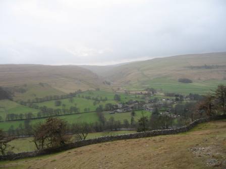
As you climb look back at the view of Arncliffe and Littondale
A good path continues to climb diagonally, crossing a couple of walls before hitting the wall that runs NW/SE along the ridge.
The path is well signposted. The climbing for the day is now done! Ahead is Great Whernside and to your left Buckden Pike.
Cross the wall and begin the descent into Kettlewell (30 mins away).
The path drops down diagonally right towards a wall, crossing a track (don't turn right along the track to a 5 bar gate) before hitting the wall on your right at a ladder stile.
Cross the wall and continue to descend diagonally right.
The views of Wharfedale open up left wonderful.
The path crosses a track (FP) before hitting gate Cote Scar. The path drops down a crack in the scar before descending steeply down to a wall. Cross the wall and drop down to a track and the end of the descent. At the track (FP) turn right, go through a 5 bar gate and at the main Kettlewell/Grassington road turn left and cross the bridge over the Wharfe. On the far side turn left into the car park
Summary
An excellent walk with good views from the tops and the fantastic atmosphere of two magnificent Dales - Wharfedale and Littondale. Along the whole length of the walk there is plenty of interesting wildlife and fauna in the spring and summer. Today there were crows, rooks, dippers, etc. Both Dales were magnificent
We saw one walker all day. He was coming out of Arncliffe and was wearing willies. Bit blowy' was his total conversation. How right he was.
The route is easy to follow following good paths that are well marked.
Home Start Point Dales Books Related Sites TextOnly Map&Summary
Home Start Point Dales Books Related Sites TextOnly Map&Summary


 .
.
.
 .
.


..